NavViewer

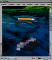
This is a shot of the NavViewer program. The program shows the track that the AUV (Autonomous Underwater Vehicle) thinks it is on (based on its Inertial Navigation System) and the track that it is really on (from range data) and shows how the navigation algorithm corrects the errors in INS.

This is a visual representation of the navigation algorithm. The color of the cubes indicates the likelihood that the AUV is at that location. After taking enough depth measurements, the algorithm converges to one cube and the AUV knows conclusively where it is.

This is a color-contoured map of the ocean bottom.